


inkl. MwSt. zzgl. Versandkosten
Versandkostenfreie Lieferung
innerhalb Deutschlands
Artikel wird auf Kundenwunsch produziert – Lieferzeit ca. 2 Wochen.
Bestellung wird direkt bei Liefereingang versendet
- Artikel-Nr.: PM-5640
- Hersteller: Emlid
- Artikelname: RS2+-S-KIT
- EAN: 4250902355401
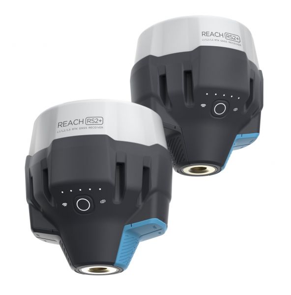
Emlid Reach RS2+ - Survey Set
Set bestehend aus:
- 2x Reach RS2+
- 2x Radio Antenna
- 2x Carry Case
- 2x USB Cable
Ausführliche Beschreibung und Technische Daten:
Reach RS2+ is the evolution of Reach RS2 receiver
LTE Modem: Now you don't need to worry about possible sunset of 3G and 2G networks in your region. New Reach RS2+ comes with power-efficient LTE modem and going to be available for next 10 years.
Dual diversity antennas: While Reach RS2 had one cellular antenna, RS2+ features dual diversity LTE antennas for better cell reception on the edge of the networks.
20+ design improvements: Based on field experience of Reach RS2, we added more than 20 design improvements that are going to ease your work.
Package includes
Gets a fix in seconds
Reach RS2+ gets a fixed solution in just seconds and maintains robust performance even in challenging conditions. Centimeter accuracy can be achieved on distances up to 60 km in RTK, and 100 km in PPK mode.
- GPS, GLONASS, BeiDou, Galileo, and QZSS
- L1OF, L2OF, L1C/A, L2C, E1B/C, E5b, B1I B2I
PPP support
RINEX raw data logs are compatible with PPP services so you can now get centimeter-precise results in any place on Earth. Process RINEX files in an online service and get position with absolute accuracy.
Built-in LTE modem
Reach RS2+ features a power-efficient LTE modem with 2G/3G fallback and global coverage. Now corrections can be accessed or broadcasted over NTRIP independently, without relying on an Internet connection on your phone.
22 hours on 1 charge
Up to 22 hours of autonomous work when logging data and up to 16 hours as a LTE rover, even in cold weather—no more need to carry spare batteries with you. Reach RS2+ can charge from a USB wall charger or a power bank over USB-C.
Surveying with ReachView 3
With ReachView 3, you can collect and stake out points and control all the features of Reach receivers, such as setting up a base station, logging RINEX data, and configuring NMEA output.
The app is available both for Android and iOS, supports thousands of coordinate systems and is translated into multiple languages.
Point collection: save points, and export data to CSV
Record each position as a point with centimeter precise coordinates. Export projects and open them in GIS or CAD software like AutoCAD, ArcGIS, QGIS, and others.
- Coordinate systems based on WGS84, NAD83, GDA2020, and others
Stakeout: find point's position on the ground
- Stakeout is used to find exact physical locations of points. They can be collected in ReachView or imported from other CAD or GIS software.
Logging in RINEX: record raw data, position, and base correction logs
Record raw data, position and base correction logs. Point collection and recording of RAW data are independent processes and can be used simultaneously. ReachView 3 has a simple and intuitive interface for logging configuration and control.
We provide our version of RTKLib for PPK. It’s free and can be downloaded from our docs.
- 16 GB storage
- 160+ days of logging at 1 Hz
PPP for OPUS
RINEX raw data logs are compatible with PPP services so you can now get centimeter-precise results in any place on Earth. Process RINEX files in an online service and get position with absolute accuracy.
Connectivity
Real-time position streaming in NMEA
Reach provides data in standard NMEA that is used by most GIS apps. Simply connect your device to Reach over Bluetooth or with a cable, and turn on “Position output” in ReachView 3.
Reach can turn on and off automatically
Reach is able turn on and off in sync with an external battery connected over RS-232. This helps when the power button is hard to reach. For example, if the receiver is placed on the roof of a tractor.
Compatible apps
- FieldGenius for Android, ESRI Collector, QField and others
Position streaming
- Interfaces: RS-232, TCP, Bluetooth
NTRIP or another Reach as a base station
Reach RS2+ needs a base station as a source of corrections. That’s a requirement for centimeter accuracy in RTK and PPK. Base might be either another Reach RS2+ receiver or an NTRIP service. VRS is also supported.
Reach RS2+ works seamlessly with other Reach receivers over any link.
Input and output corrections
- Interfaces: TCP, LoRa, Bluetooth, RS-232, NTRIP
- Formats: RTCM3
Max distance from a base
- Over 60 km in RTK
- 100 km in PPK
- Any place on Earth with PPP
Engineered to be tough
Reach RS2+ is designed to work even in the most challenging environments.
IP67
RS2+ is waterproof up to 1 m depth. All connectors are completely sealed and protected from water and dust with silicone plugs.
-20 to +65 º?
We extensively tested Reach RS2+ in conditions that simulate coldest winters and hottest summers.
Polycarbonate body
Polycarbonate, an extremely durable material that is used in bulletproof glass, makes Reach RS2+ impact-resistant.
Covered with elastomer
This is a rubber-like material that forms a shock absorber around the whole device. In a sophisticated manufacturing process, elastomer is permanently bonded to the polycarboante base so that if your bipod falls over, Reach RS2+ will bump off, no marks left.
LoRa radio
- Frequency range: 868/915 MHz
- Up to 8 km At only 100mW
- 300% more range Compared with FSK radios at the same power
LoRa Spread Spectrum modulation can work on distances up to 4 times longer compared with traditional FSK radios at the same power output. This gives Reach RS2+ robust radio performance without sacrificing battery life. LoRa radio is used to connect rover to base when Internet-delivered corrections are not available.
Industrial battery
LiFePO4: Industrial battery that handles both high and low temperatures well.
USB-C: Reach RS2+ charges from any USB port and power bank.
2 000+ cycles: of charging and discharging while maintaining original capacity.
Reach RS2+ works for up to 22 hours in static logging and up to 16 hours in RTK with cellular on. You don't need to worry about having spare batteries or replacing them in the field. Hot-swaps are a thing of the past.
Compact and lightweight
126 ? 142 mm, Fits in a small bag
950 g, Weighs less than a typical survey pole
*Comes with LoRa antenna, USB cable, and carring case with a strap*
Technische Daten:
Mechanical
- Dimensions 126 x 126 x 142 mm
- Weight 950 g
- Operating tº -20 to +65 ºC
- Ingress protection IP67
Electrical
- Autonomy 16 hrs as LTE RTK rover,
22 hrs logging - Battery LiFePO4 6400 mAh, 6.4 V
- External power input 6–40 V
- Charging USB Type-C 5 V, 2 A
- Certification FCC, CE
Positioning
- Static H: 4 mm + 0.5 ppm
V: 8 mm + 1 ppm - PPK H: 5 mm + 0.5 ppm
V: 10 mm + 1 ppm - RTK H: 7 mm + 1 ppm
V: 14 mm + 1 ppm - Convergence time ~5 s typically
Connectivity
- Lora Radio Frequency range
Power
Distance 868/915 MHz
0.1 W
Up to 8 km - LTE modem Regions
Bands Global
FDD-LTE: 1,2,3,4,5,7,
8, 12, 13, 18, 19, 20,
26, 28, 66
TD-LTE: 38,40,41
UMTS (WCDMA/FDD):
1,3,2,4,5,6, 8,19
Quad-band, 850/1900,
900/1800 MHz SIM card Nano-SIM - LTE modem Regions
Bands Global
FDD-LTE: 1,2,3,4,5,7,
8, 12, 13, 18, 19, 20,
26, 28, 66
TD-LTE: 38,40,41
UMTS (WCDMA/FDD):
1,3,2,4,5,6, 8,19
Quad-band, 850/1900,
900/1800 MHz SIM card Nano-SIM - Wi-Fi 802.11 b/g/n
- Bluetooth 4.0/2.1 EDR
- Ports RS-232, USB Type-C
Data
- Corrections NTRIP, RTCM3
- Position output NMEA, LLH/XYZ
- Data logging RINEX
- Internal storage 16 GB
160+ days of logging at 1 Hz
GNSS
- Signal tracked GPS/QZSS L1C/A, L2C
GLONASS L1OF, L2OF
BeiDou B1I, B2I
Galileo E1B/C, E5b - Number of channels 184
- Update rates up to 10 Hz
- IMU 9DOF
Hersteller gemäß (GPSR (EU)2023/988):
Emlid Tech, Korlátolt Felelősségű Társaság, Esztergomi út 31-39. HUB3. ép. 5. em. Budapest, 1138, Ungarn https://eu.store.emlid.com/